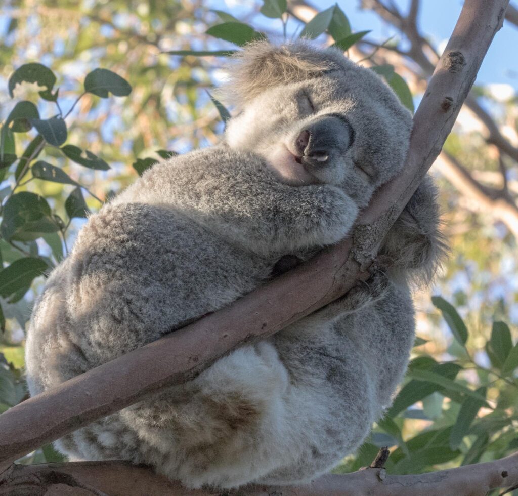
Koalas have been seen around the Sutherland Shire over the last couple of years at Sandy Point, Woronora, Woronora Heights, Engadine, in the Royal and Heathcote National Parks, and surrounding bushland.
It’s wonderful we have koalas in and around Sutherland Shire. We also need to take care they are protected.
In 2022 koalas were formally listed as Endangered under the Commonwealth Environment Protection and Biodiversity Conservation Act. This follows a report from the NSW Legislative Council inquiry Koala populations and habitat in New South Wales which found koalas could become extinct in NSW by 2050 without urgent government intervention.
That report recommended State government ‘urgently prioritise the protection of koala habitat and corridors in the planning and implementation stages of urban growth areas’. It notes that wildlife corridors ensure ‘safe connectivity between habitat areas’ and are ‘essential for the survival of koalas.’ They allow animals to move freely over the landscape, find mates, build genetic diversity, escape difficult conditions, and maintain populations at viable levels.
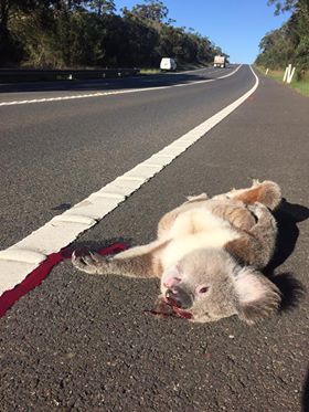
Sadly, quite a few koalas are still being killed on the roads around the Shire, at least 25 we know about just in the last few years. Heathcote Rd in particular has now become known as a notorious kill zone, with 11 koalas that we know of dying there between October 2022 and September 2023.

With other advocacy groups we’ve been flagging this issue with various government agencies for a number of years, and in an effort to prevent further kills we recently began a fundraising campaign for additional signs on the road.

Thank you to Symbio Wildlife Park, Oatley Flora and Fauna Conservation Society, Woronora Valley Residents Association, and all who’ve been so generous with donations to support these keeping these signs up till the end of breeding season.
But when we think of the whole Shire landscape, Heathcote Rd isn’t the only concern. Further south, wildlife corridors between our national parks are also blocked too – the F6 acts as 30-40m wide barrier, with the South Coast train line adding another 25m to that distance. The kill rate here is not as high as Heathcote Rd, but koalas from bushland around Waterfall, Engadine, and the Heathcote National Park have been hit on the F6 as they’ve tried to cross the road over to the Royal National Park.
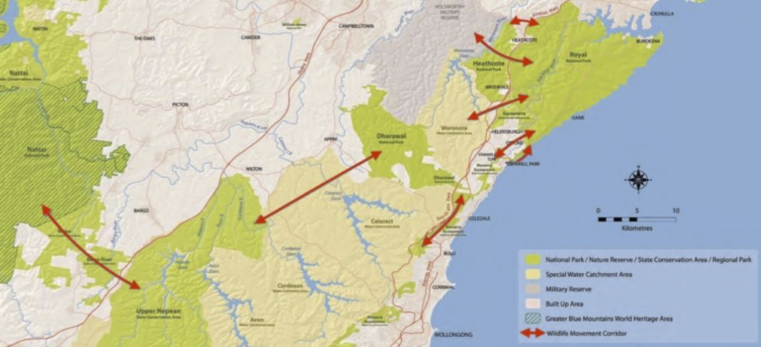
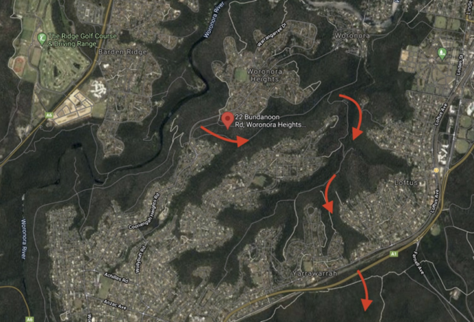
Wildlife corridors are recognised as critical to the survival of many native species, and the National Parks and Wildlife Service have known about the wildlife corridors shown in the image to the left for decades.
A number of underpasses and overpasses between national parks have been incorporated as part of the Mona Vale Road upgrade. It’s reasonable to expect such measures would be put in place to protect the biodiversity of Australia’s first national park, and we stressed this point in a submission to the plan of management for the Garawarra State Conservation Area, Royal and Heathcote National parks.
We held a webinar on wildlife crossings recently with Associate Professor Ross Goldingay who in 2022 published one of the most detailed studies of the use of underpasses by Australian wildlife that has been completed to date. The second speaker, Northern beaches wildlife activist Jackie Marlow, played a key role in advocating for overpasses and underpasses for the new Mona Vale Road upgrade.

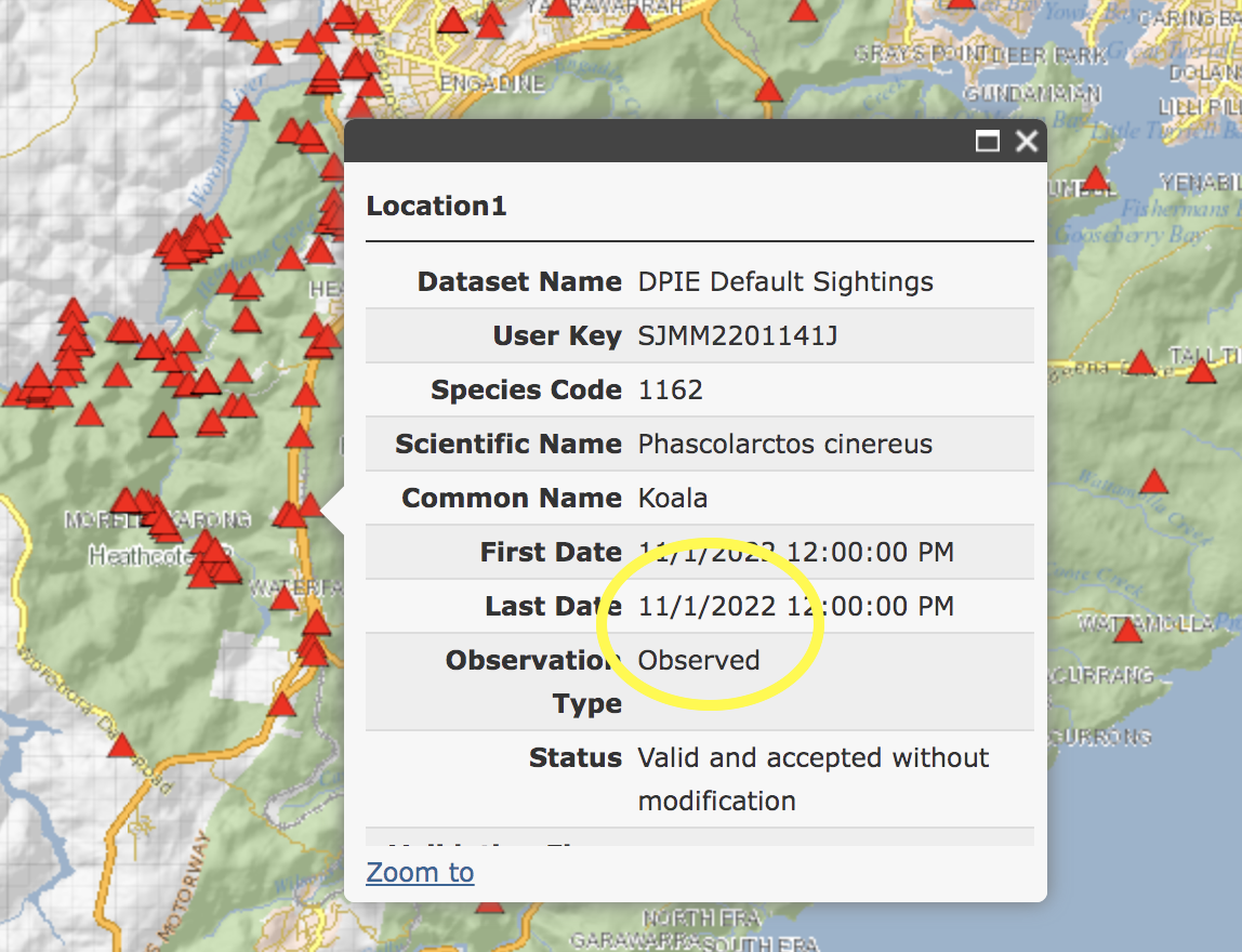
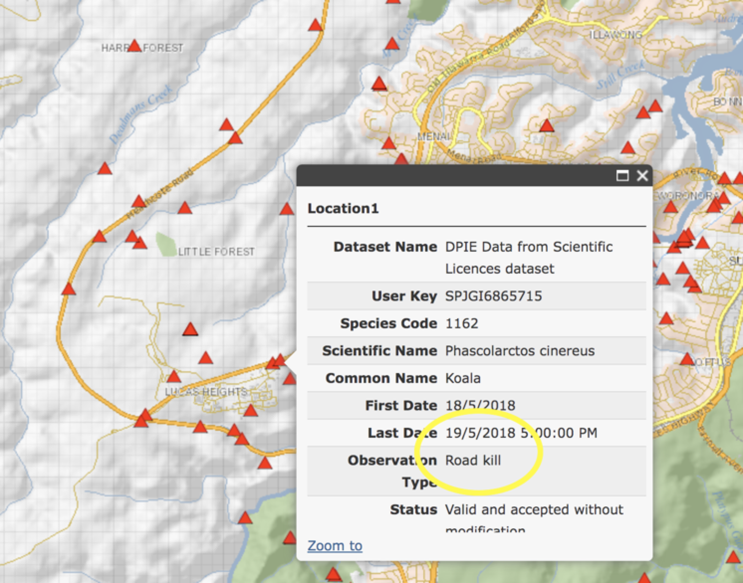
The little red triangles in this diagram to the left are koalas that have been seen around the Shire to July 2023. Current estimates suggest we have 170-200 koalas across the area. This is not many. Sadly many sightings on roads are koalas that have been hit by cars; and injured or killed.
Retaining wildlife corridors and connectivity across a landscape is vitally important if we want our local population to thrive. Over the last few years we’ve put in submissions to Sutherland and Wollongong council, have met with State MPs, and representatives from State government agencies, including the NSW Koala Strategy team and TransportNSW.
We’ve also been liaising with other local environmental groups, including members of the Sydney Basin Koala Network.
We’re hoping that as as a result of this advocacy that the NSW government will take action to prevent koalas being killed on roads, and implement a Koala SEPP across the area so that koala management plans can be formalised.
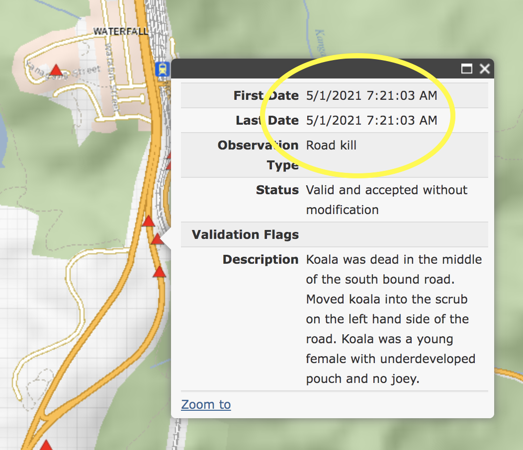
Recent Bionet records of koalas killed and observed around Heathcote and Waterfall on F6 and surrounding roads

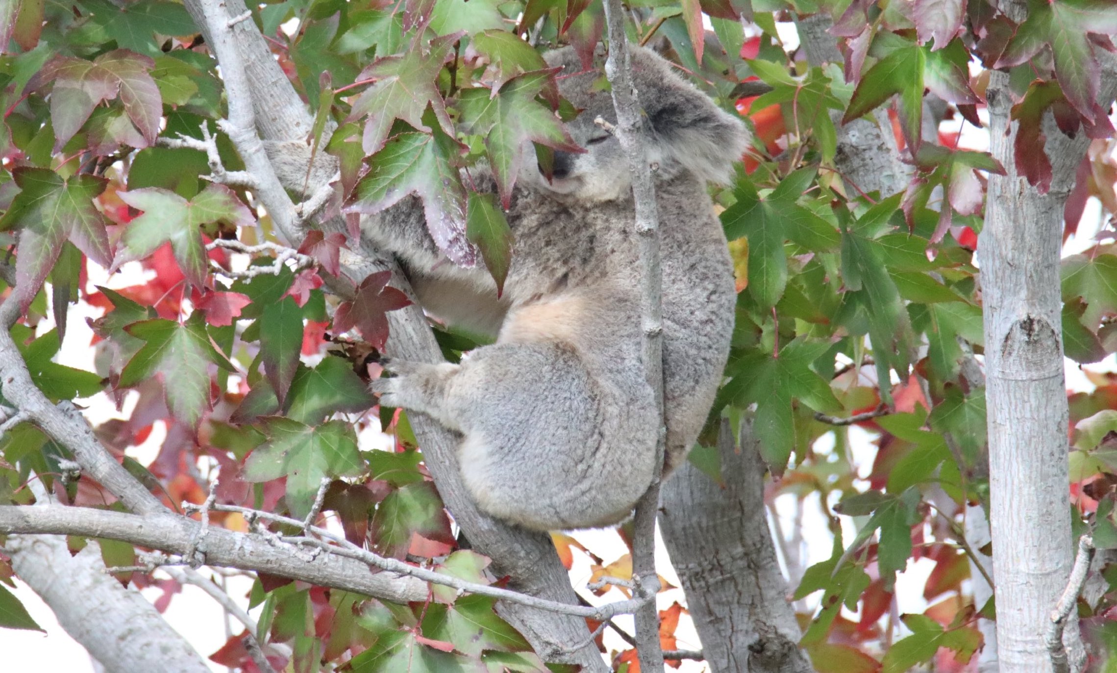
And a beautiful koala mother and joey in Heathcote National Park


We’re lucky we have healthy koalas locally. But the numbers we have are relatively small, and as such, vulnerable.
Genetic testing has shown that our Sutherland Shire koalas came from the Campbelltown and Appin colony originally. That colony numbers over a thousand. If our local population is destroyed by another 1994 bushfire, theoretically, koalas from the Campbelltown / Appin population would migrate back to the Shire.

The fate of these south west Sydney koalas is not secure. The Greater MacArthur Growth Plan will see prime koala habitat replaced with over 40,000 new homesites. It is not clear if this large koala colony will survive the land clearing that will take place.

The Save Sydney’s Koalas group have been working with the Total Environment Centre, asking the Ministers for Planning and Environment, and the local council, to take action to protect habitat, and ensure sufficiently wide corridors connect the Georges and Nepean Rivers. Developers such as Walkers and Lendlease have already begun submitting DA modifications trying to wind back protections for koalas across this area. News reports continue to identify terrible statistics about numbers of koalas there being killed on roads.
These koalas belong to all of Sydney, as well as being so important for our local Sutherland Shire population. The Total Environment Centre and the Sydney Basin Koala Network have a new video about what is proposed. If you’d like to find out more information and write to the Ministers responsible for signing off on these development decisions, there’s more information on the Total Environment Centre website: https://www.tec.org.au/cumberland_plain_conservation_plan
______________________
The following section provides information about areas where koalas protections could be put in place from the Shire down to Helensburgh.

Four main locations are identified, including a number of “kill zones”:
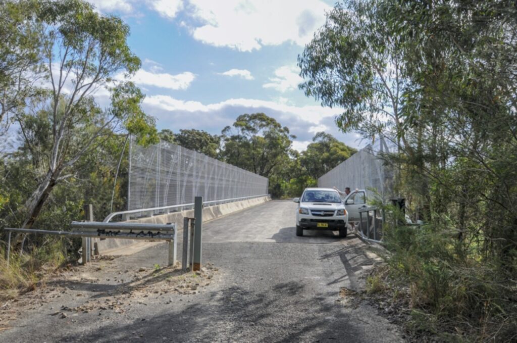
1. Cawley’s Bridge near Helensburgh crosses the F6 Freeway at Garawarra: it is not used as a public road, but remains a service road for various agencies. This bridge could be easily be transformed to offer a critical wildlife corridor allowing native animals safe passage from Heathcote National Park and the Woronora Special Area catchment through to the Garawarra State Conservation Area and on to the Royal National Park.
2. the Deadman’s Creek koala kill zone at Heathcote Road at Sandy Point.
3. around the Lucas Heights precinct; and
4. around Heathcote Road Bridge over the Woronora River.
Ideally the NSW government would be encouraging National Parks management to investigate the feasibility of developing wildlife crossings at a range of locations.
______________________
1. Potential crossings over F6 Freeway: a proposed repurposing of Cawley’s Bridge at Garrawarra, and another potential overpass site at Loftus
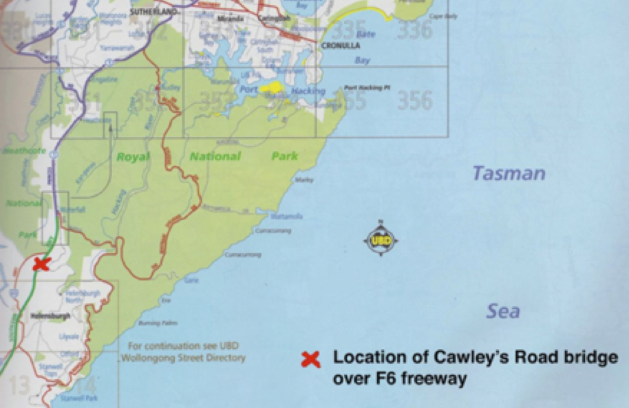
Cawley’s bridge south of Waterfall could potentially allow native animals safe passage over the F6 from Heathcote National Park and the Woronora Special Area catchment through to the Garawarra State Conservation Area and on to the Royal National Park.
The Royal National Park has become increasingly isolated from surrounding natural lands. Some species originally found in the Park are now locally extinct.
Repurposing Cawley’s bridge into a wildlife overpass can be done for relatively minimal cost. One lane of the service road could be retained: it may only be necessary to convert one side of the bridge into suitable wildlife habitat crossing.
Sheltered walkways could be built on the bridge rails for the use of arboreal species and connected to nearby trees to allow wildlife to safely access the crossing.
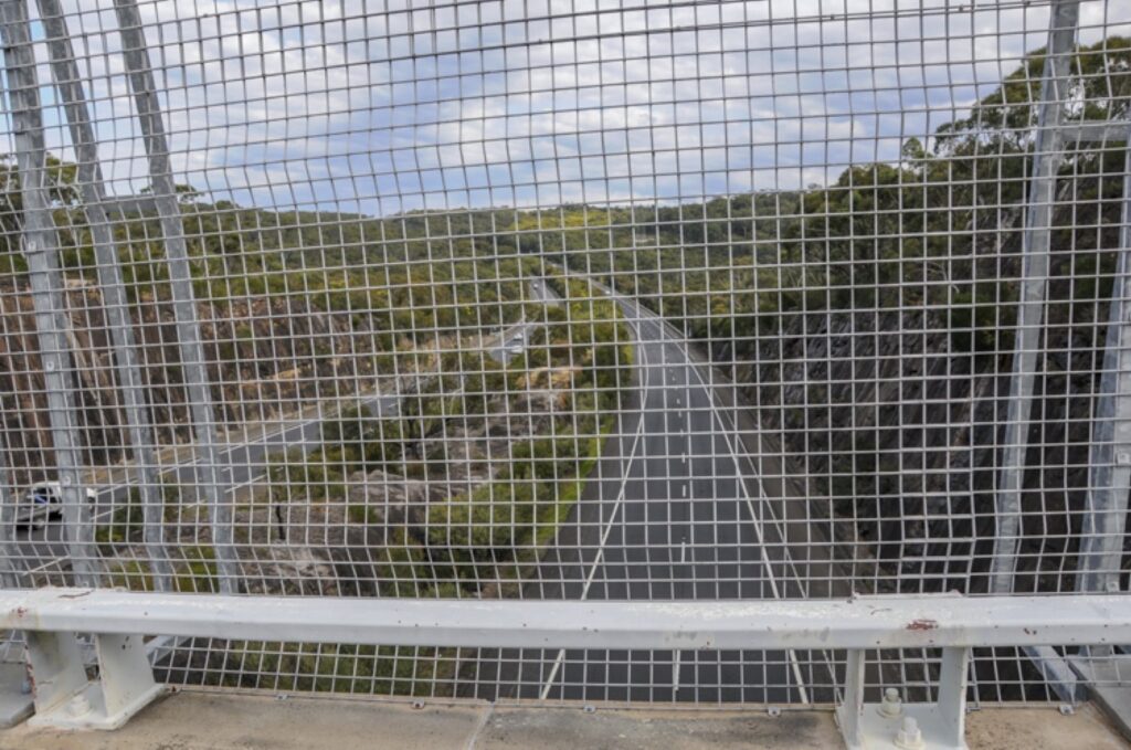
At Cawley’s Bridge ▼ with a bird’s eye view of the great division of the natural landscape and obstacle to wildlife movement presented by the F6 freeway

The Compton Road overpass in South-East Queensland provides evidence that Cawley’s bridge could be successfully transformed in this manner.
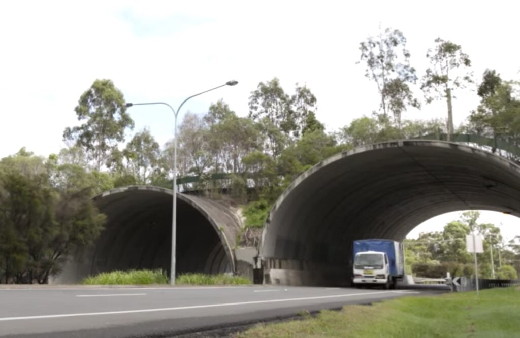
Compton Road is a major east-west arterial road similar to the F6. In the 10 years since the completion of the land bridge there, only 3 mammals have been killed from motor vehicle accidents. Before this, 5 were killed on this road every month.

The overpass at Compton Road is planted with locally sourced vegetation making a seamless connection to the surrounding forest. It features rope ladders for possums, poles for gliders and customised culverts to act as tunnels for small animals to pass beneath the road.
Rope ladders are important for arboreal animals such as gliders. Greater Gliders were thought locally extinct in the Royal National Park following the 1994 bushfires. The wonderful news is that they have recently been seen again, with three sightings over the last ten years.
Our local Greater Glider population may still be too small to survive. Anything that might build genetic diversity would be valuable.
With Compton Road, another important component of the wildlife crossing is adjacent fencing which funnels wildlife towards the safe crossings, away from busy roads.
This customised fencing is 2.48m, much higher than regular road fencing. This stops animals such as wallabies and kangaroos from gaining easy access. Metal sheet strips deter climbing animals such as koalas and possums. The project has apparently been used to guide best practice designs at a number of major road construction approvals across Australia, and is now industry standard for roads incorporating wildlife management measures.
The Compton Road overpass is a model for what can be achieved with wildlife overpass crossings and has been duplicated across Europe, with seven overpasses in Sweden alone.
In addition to Cawley’s bridge these measures would also be easy to implement along Heathcote Road at Sandy Point, the Lucas Heights Precinct, and Woronora Bridge.
See this Gardening Australia YouTube video ▼ for an overview of the Compton Road overpass – and what could be possible at Cawley’s bridge across the F6
____________________________
There is one further site at Loftus between houses that could, potentially, offer another crossing location over the F6 from the Royal National Park to bushland through to Loftus Creek and Woronora.
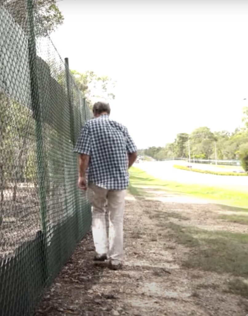
As we pointed out in a recent submission opposing the subdivision of land owned by Sydney Water at Woronora Heights, this whole area is a wildlife corridor, and koalas have been sighted around that location.
This corridor leads from the Woronora River through to Loftus. At Loftus there is a potential site for a future wildlife crossing. We flagged this spot in our submission to the Royal National Park draft plan of management.
It would be wonderful to link this landscape which was artificially divided when the freeway was put in.
______________________
2. Sandy Point – the Deadman’s Creek kill zone

Sandy Point is just across from the Holsworthy military training base which was devastated by fire in 2018. Koalas inhabit that base. As koalas move around this area to seek alternate food sources or to breed they face one of the worst kill zones in Sutherland Shire, Deadman’s Creek at Sandy Point.
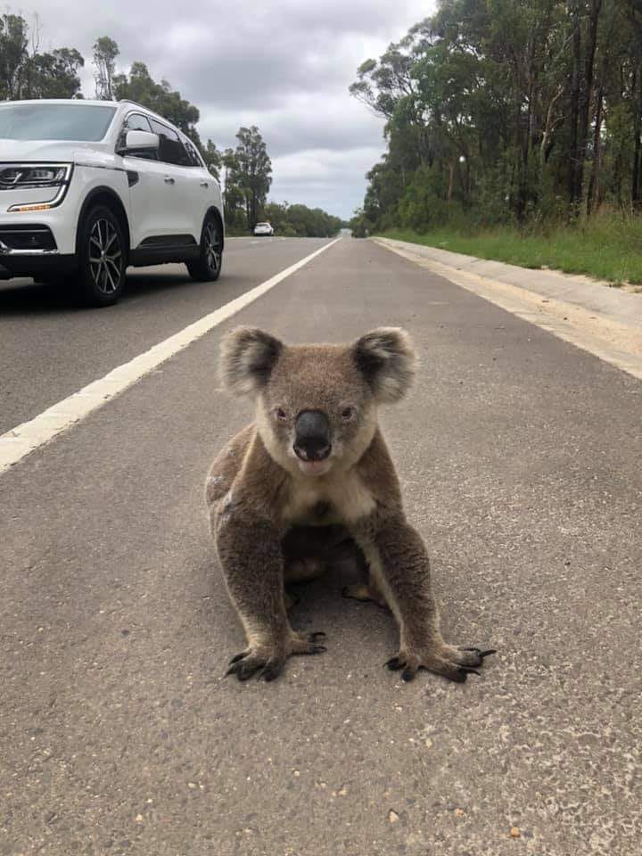
A significant number of koalas have died on the road here: 6 koalas in 2018 alone. The death rate has remained consistently high since then, from October 2022 to September 2023, 8 koalas that we know of were killed there, and one lucky koala mother and joey rescued from the road.
An underpass already exists under the Deadman’s Creek bridge which could be modified to allow safe passage for these koalas. As with Compton Road, directional fencing could be installed next to the road to funnel wildlife towards the underpass.
After considerable consultation with a range of groups, in December 2021 TransportNSW published a report into road kill mitigation measures at Deadman’s Creek .
In December 2023 we are still waiting for many of the recommendations to be implemented.
A Sandy Point resident saw this koala mother and joey on the road in September 2020. They survived, but two other koalas were killed at Deadmans Creek that month.
At the moment there appears to be an impasse where the Federal Department of Defence has erected a fence alongside the road which does nothing to stop koalas getting on to the road, but also makes it harder to access the underpass under the bridge. The NSW State government Department Transport NSW now has to liaise with Defence to retrofit the fence. Koalas meanwhile continue to die on that section of the road.

Clear-felling of koala habitat at the Moorebank Intermodal Site and the relocation of the new Army Logistics site on Moorebank Rd has further jeopardised koala habitat around this whole area.
3 & 4. The Lucas Heights precinct, and the Heathcote Road bridge over Woronora River
Koalas have also been killed around New Illawarra Rd near ANSTO, and along Heathcote Road down toward the bridge over Woronora River.
In February 2021 we put in a submission to TransportNSW about possible roadkill mitigation measures for the Heathcote Road Bridge widening project. This has not been acted on. Koalas are still dying on that section of the road: two in June 2023.
The upgrade offered an ideal time to install koala friendly wildlife crossing and fencing. These measures could, theoretically, have also been implemented around ANSTO’s Lucas Heights Innovation Precinct.
The diagram to the right shows where koalas have been sighted in the area. The diagram under that likely routes along creek lines which koalas are taking to move around the landscape near Heathcote and New Illawarra Roads toward Engadine and the Woronora River.


We have a population of perhaps 175-200 koalas in the Shire. To lose 25 to road kill is a shocking toll.
The failure of various government departments to address this is very troubling.
Whether or not koalas become extinct in the wild by 2050 will be a result of political choices, including those that allow bureaucratic inertia.
An estimated 3 billion animals died in the devastating 2019-20 bushfires. In relation to koalas specifically, the NSW Legislative Council inquiry has advised government urgently needs to assist in protecting remaining populations in order to conserve habitat.
_____________________
For more information, or if you’d like to help, please contact campaign convenors John Souvleris and Dr Catherine Reynolds: office@ssec.org.au
_____________________

If you see a koala please be sure to report him / her on the I Spy Koala app.
Government agencies make decisions based on the numbers of koalas that are reported.
* Please let your friends know we need to report every sighting.
Further reading and more photos of beautiful koalas
17 December, 2023, “Symbio Wildlife Park funds koala warning signs on Heathcote Road until end of mating season“, The Leader

30 November, 2023, Submission to the Illawarra Sutherland Rural Fire Service regarding the Sutherland Draft Bush Fire Risk Management Plan
30 November, 2023, “Koala habitat sites at Engadine, Woronora Heights and Woronora to benefit from $200,000 in federal govt funding“, The Leader
30 November, 2023, “Sandy Point couple rescue another koala from middle of Heathcote Road“, The Leader
23 November, 2023 “Spike in koala deaths prompts call for better road design, lower speed limits in NSW” ABC Illawarra
24 October, 2023, “Koala sustained no injuries despite near-death experience on Heathcote Road“, The Leader
16 October, 2023, “Public support enables Sutherland Shire Environment Centre to extend koala warning signs on Heathcote Road“, The Leader
9 October, 2023, “Valiant attempt to save injured koala on Heathcote Road has sad ending“, The Leader

3 October, 2023, “NSW Roads Minister urged to lower Appin Road speed limits to address rising koala fatalities“, ABC Illawarra
2 October, 2023, “Sutherland Shire Environment Centre adds two more koala warning signs on Heathcote Road“, The Leader
21 September, 2023 “Sutherland Shire Environment Centre adds two more koala warning signs on Heathcote Road“, The Leader
20 September, 2023 “New signs to be installed on Heathcote Rd to protect koalas in mating season“, Daily Telegraph
18 September, 2023 “Concerns at delay in introducing measures to deter koalas from crossing Heathcote Road at key locations“, The Leader
8 September, 2023 “Koalas at forefront of planning for major hazard reduction burn in Sydney’s south west, RFS says“, ABC News
17 August, 2023, “Threats mounting for the last of Sydney’s healthy koala population“, Sydney Morning Herald

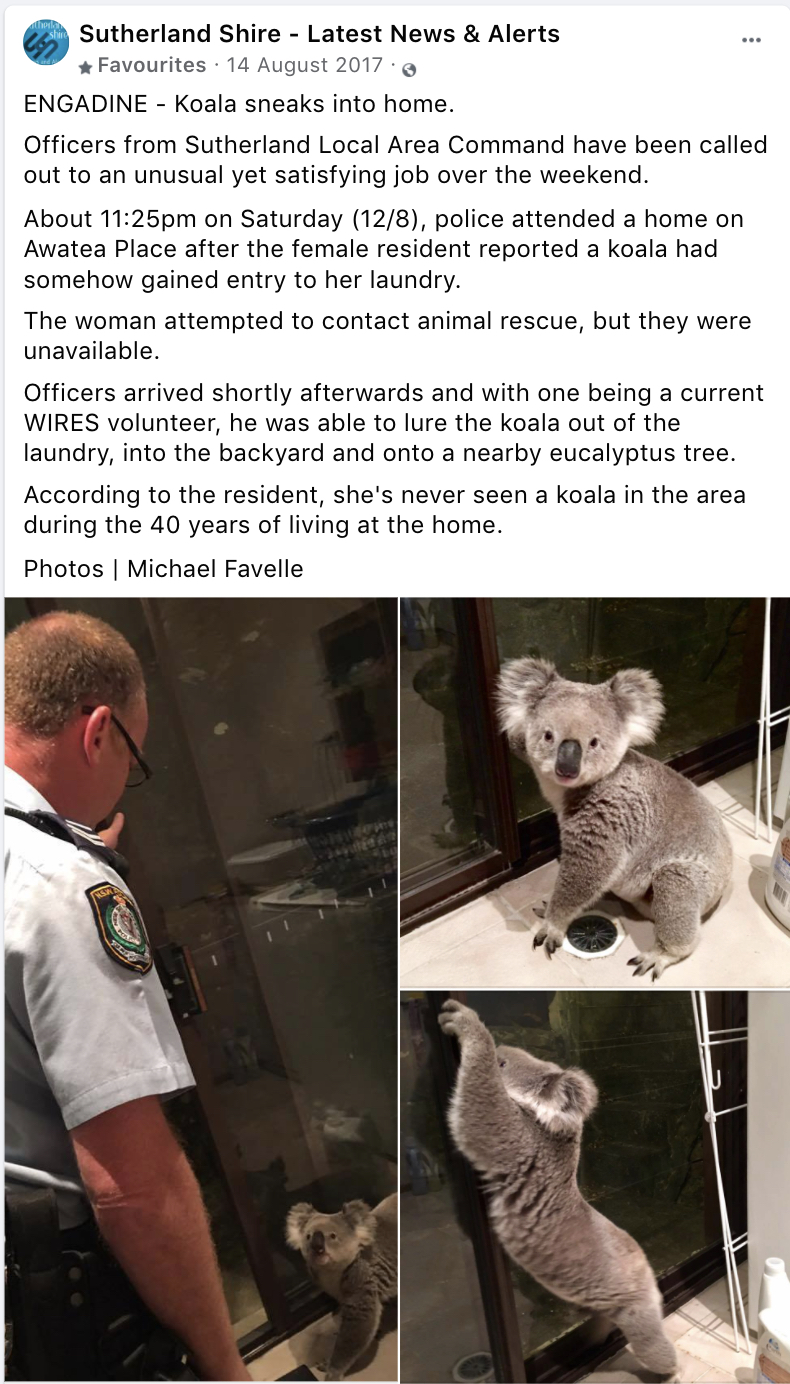
8 August, 2023 “Wonnie the koala found in kitchen of Woronora Heights home“, The Leader
2 August, 2023, “Increase in koala roadkill prompts calls for more safety measures“, ABC Illawarra
1 August 2023, “VIDEO: Sydney roads becoming dangerous for koalas“, ABC News
7 September, 2023 “Eight signs to be erected on Heathcote Road urging motorists to watch out for koalas“, The Leader
30 June, 2023 “Southern Sydney’s Heathcote Road koala ‘kill zone’, dangerous to rescuers and marsupials” ABC Illawarra
22 March, 2023, “Video: Dramatic increase in number of Koalas being hit by cars“, ABC News
21 March, 2023, “Fears Sydney koalas on road to extinction as ‘devastating’ statistic revealed“, Yahoo News Australia
February 2023, “Protecting koalas in the Sydney Basin bioregion“, Environmental Defenders Office
February 2023, “Sydney Basin Bioregion: Koala habitat and population assessment“, Biolink Ecological Consultants
7 December, 2022,”Koala and joey found ‘running down road’ at Sandy Point“, The Leader
2 September, 2022, Merrill Witt, “The NSW Government puts South West Sydney koalas on pathway to extinction” New Bush Telegraph
1 August, 2022, Ross Goldingay, “Good news: highway underpasses for wildlife actually work” in The Conversation
Ross L. Goldingay, David Rohweder, Brendan D. Taylor, Jonathan L. Parkyn, 2022, “Use of road underpasses by mammals and a monitor lizard in eastern Australia and consideration of the prey‐trap hypothesis“, Ecology and Evolution, 12, e9075
22 March, 2022 “Experts to lead webinar discussion on need for wildlife crossings in Sutherland Shire” The Leader
25 September, 2021 “Koala to be released soon back into bushland near where he was found injured at Woronora” The Leader
13 September, 2021 “WIRES removes koala from Woronora bushland after public attention and injury concerns” The Leader
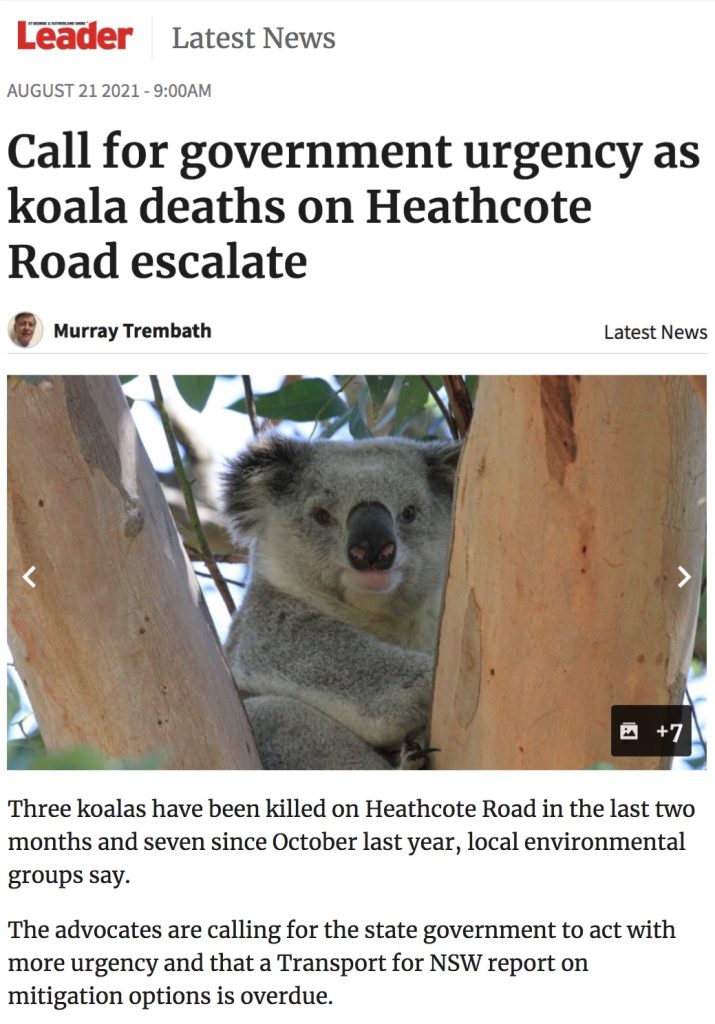
21 August, 2021 “Call for government urgency as koala deaths on Heathcote Road escalate” The Leader
7 Jul 2021, “Cars strike koalas on Sydney’s fringe with delays to wildlife underpasses” ABC Illawarra
31 May, 2021 “Sydney Water prepares to sell off bushland in area occupied by koalas at Woronora Heights” The Leader
1 May, 2021 “New documentary film tells story of koalas on Sydney’s southern and south-western fringe” The Leader
10 April, 2021 “Sydney’s hamlet tragedy: urban sprawl conquers all” The Sydney Morning Herald
22 February, 2021 “Submission to Transport NSW regarding the Heathcote Road Bridge Widening Project”
6 February, 2021 “‘How good were koalas?’: A national treasure in peril” The Sydney Morning Herald
10 January, 2021 “Drones count koalas faster and cheaper than manual spotting methods: study” ABC News
Ryan R Witt, Chad T Beranek, Lachlan G Howell, Shelby A Ryan, John Clulow, Neil R Jordan, Bob Denholm, and Adam Roff, 2020, “Real-time drone derived thermal imagery outperforms traditional survey methods for an arboreal forest mammal“, Plos one, Volume15, Issue11
19 December, 2020 “Reuben may be heading to the shire for Christmas” The Leader
3 December, 2020 “St Joseph’s Primary School students support koala conservation” The Leader
27 October, 2020 “Destruction of Appin koala habitat a disgrace” The Sydney Morning Herald
1 October, 2020 “Koala carnage on Sutherland Shire roads continues” The Leader
30 September, 2020 “Video of mother and baby koalas on Heathcote Road to add pressure for protection measures” The Leader
21 September, 2020 “Fence-off the koala kill spots, environment groups say” The Leader
6 August, 2020, A koala found in Kirrawee – captured and released in the Royal National Park: “Rescue koala fitted with tracking device before being released in Royal National Park” 7NEWS Sydney
21 July, 2020, Sutherland Shire Environment Centre Submission to Sutherland and Wollongong Councils – Recommendations for Increased Protection for Koalas and Resilient Habitat in the Sutherland Shire, to Helensburgh
10 July, 2020, “Renewed calls to protect koalas who move through area from upper Georges River to shire’s western fringe” The Leader
May, 2020 Protecting Sydney’s Macarthur Koala Colony – The Survival Plan, Total Environment Centre
20 February, 2020 “Analysis: Koalas: new laws – old tricks”, Environmental Defenders Office
18 February, 2020 “Bushfires hastening NSW koala extinction” The Leader
20 January, 2020, Sutherland Shire Environment Centre Submission to Matt Kean MP, NSW Minister for Energy and Environment, regarding the expansion of Heathcote National Park and protection of Koala Habitat in the Sutherland Shire,
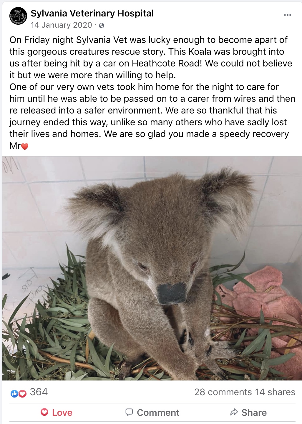
16 January, 2020 “Sylvania Veterinary Hospital helps nurse injured koala back to health” The Leader
Ross L. Goldingay, Brendan, D. Taylor, and Jonathan L. Parkyn, 2019, “Movement of small mammals through a road-underpass is facilitated by a wildlife railing”, Australian Mammalogy, 41: 142–146
Saving Wildlife – the Compton Road effect, Griffith University https://www.griffith.edu.au/research/impact/compton-road-wildlife-corridor
14 August, 2019 “Say goodbye to southwest Sydney koala population” Independent Australia
Ross L. Goldingay, Brendan, D. Taylor, Jonathan L. Parkyn, and John M. Lindsay, 2018, “Are wildlife escape ramps needed along Australian highways?”, Ecological Management & Restoration, Vol 19 No 3 September: 198-203
Wildlife Crossings supported by the NSW Roads and Maritime Services – “Gliders take the high road: Study proves highway fauna crossings are being used by threatened species”, ABC News, 19 July, 2018
Dean Karas, 2018 “Scoping for potential wildlife crossings for koalas and marsupial gliders in the Sutherland Shire and Campbelltown regions of New South Wales, Australia” University of Wollongong Thesis Collection
Wildlife Movement Solutions Brisbane City Council https://www.brisbane.qld.gov.au/clean-and-green/natural-environment-and-water/biodiversity-in-brisbane/wildlife-in-brisbane/wildlife-movement-solutions
3 October, 2018 “Six koalas killed on Heathcote Road in last year sparks call for action” The Leader
R. L. Goldingay, 2017, “Persistence of Australia’s most threatened snake (Hoplocephalus bungaroides) in Australia’s oldest National Park”, Journal of Zoology 304: 202–209
27 September, 2017 “Rare sighting of koala mother with her joey in Heathcote National Park” The Leader
1 September, 2017, “Koala rescued from busy road at Lucas Heights“, Illawarra Mercury
7 November 2016 “Mt Kembla’s ‘new’ koala population” NSW Department of Planning and Environment media release

26 July, 2016 “Koalas tunnels and bridges prove effective on busy roads” Brisbane Times
In Search of the Illawarra Koala blog post, with a history of koala sightings around the Illawarra, dating back to 1803
Stuart Pell and Darryl Jones, 2015, “Are wildlife overpasses of conservation value for birds? A study in Australian sub-tropical forest, with wider implications”, Biological Conservation 184: 300–309
11 September, 2013 “Injured koala rescued on Heathcote Road”, The Leader
Brendan D. Taylor and Ross L. Goldingay, 2013, “Squirrel gliders use roadside glide poles to cross a road gap”, Australian Mammalogy, 35: 119–122
August 2013, Tristan Lee, “Fine-scale population genetics studies of koala populations in New South Wales and Victoria” University of Sydney
Brendan D. Taylor and Ross L. Goldingay, 2012, “Restoring Connectivity in Landscapes Fragmented by Major Roads: A Case Study Using Wooden Poles as Stepping Stones for Gliding Mammals”, Restoration Ecology, November, Vol. 20, No. 6: 671–678
3 September 2012, Ross Goldingay, “What Role Does Ecological Research Play in Managing Biodiversity in Protected Areas? Australia’s Oldest National Park as a Case Study” in Proceedings of the Linnean Society of New South Wales 134: B119-B134
VicRoads Fauna Sensitive Road Design Guidelines, 2012
2006, Michael Organ, The Scientific Discovery of the Koala: Hat Hill (Mount Kembla), New South Wales 1803
4 December 2003, “Cutting the carnage: wildlife usage of road culverts in north-eastern New South Wales”, CSIRO Wildlife Research 30(5)
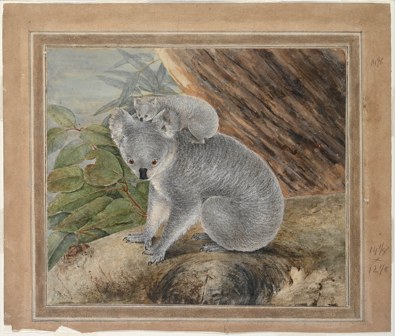
Spot the koala, Royal National Park, January 2020 – photo credit – Audley Boatshed